Charting the Depths of Our 2.3 Million Sq Km Blue Frontier with High-Resolution Precision
Mauritius commands an Exclusive Economic Zone (EEZ) of over 2.3 million square kilometers—a vast oceanic territory holding immense economic, ecological, and strategic potential. Understanding, managing, and protecting this environment is our greatest operational challenge.
Traditional manned surveying is slow, expensive, and limited by offshore weather conditions. Ocean Prime's Unmanned Surface Vessels (USVs) redefine how we interact with our ocean state. By deploying autonomous fleets, we can collect high-resolution data, map shifting seabeds, and monitor our waters continuously, securely, and at a fraction of the traditional cost.
Discuss Survey Projects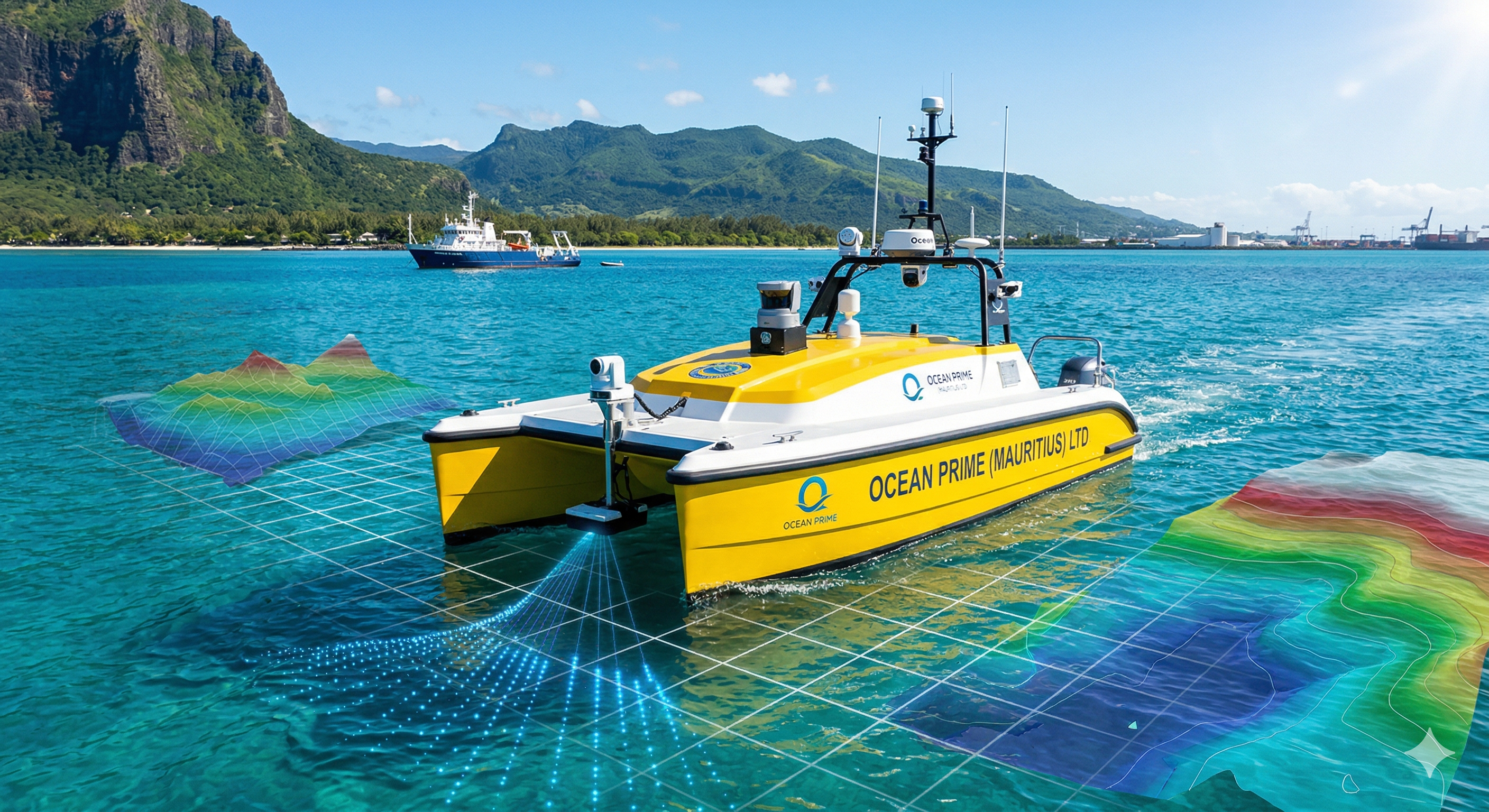
USVs consume significantly less energy and eliminate crew-related expenses, greatly reducing the long-term operational costs for extensive offshore surveys and inspections.
Equipped with advanced navigation, our USVs perform incredibly precise maneuvers. They can get close to complex foundations and structures for high-resolution detection and accurate data collection.
Capable of continuous monitoring, USVs remove surveillance gaps in vast offshore areas. They can promptly spot and handle unauthorized entries, enhancing overall maritime security.
Operating in the tough, unpredictable offshore environment, autonomous vessels keep human workers out of harm's way, protecting lives and high-value assets during operations.
Unmanned vessels quickly map extensive seabed areas across our EEZ, accelerating project planning with faster, automated data collection compared to traditional methods.
USVs can operate safely in complex nearshore waters, erosion zones, and shallow areas where conventional deep-draft vessels cannot reach, ensuring complete site coverage.